Home · Flooding
Flooding
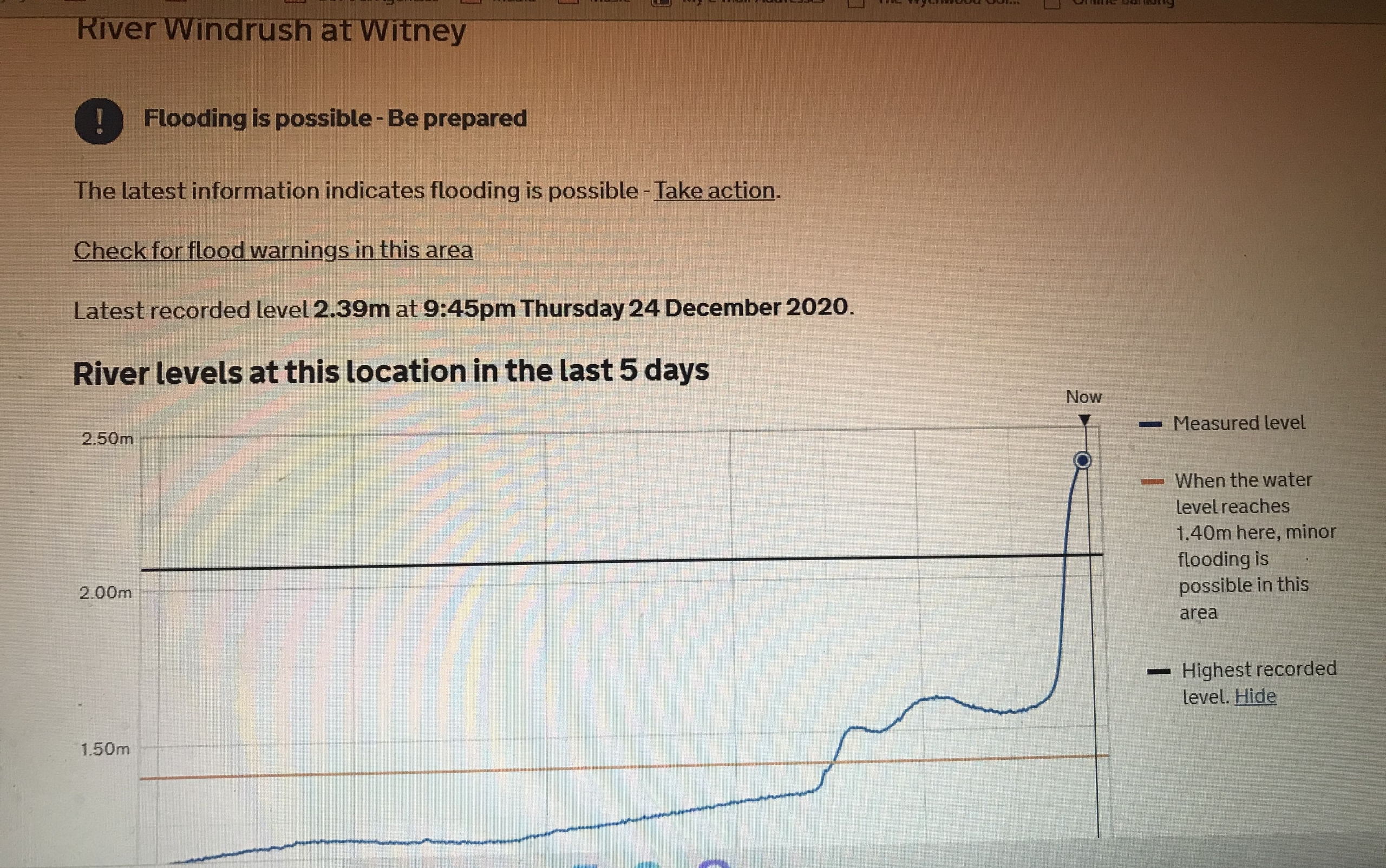
This area has been subject to major flooding, most notably in 2007, 2014 & 2020, with the flooding of houses in Hailey Road, West End, Bridge Street, Riverside Gardens and Jacobs Mill. The land earmarked for housing contains Blue Oxford Clay, so rainwater runs off quickly, causing flash flooding. With its three major tributaries feeding into the Hailey Road Drain plus the increasing effects of climate change, it is a recipe for continued flooding.
The fields north of Witney flood — in 2007, 2014 and 2020 homes flooded and care-home residents were evacuated. Water pours off the fields into the Hailey Road Drain, which runs underground beneath homes and roads. Building 1,250 houses on those fields, on Blue Oxford Clay, makes this worse — and the Environment Agency has thrown back every flood-mitigation proposal so far.

"The flooding on the Hailey Road should be considered the most significant flooding in Witney, at least for the July 2007 event, because it posed the biggest threat to life."Witney Flood Review, July 2007 — Environment Agency (extract, p10)
"At least 54 residential and business properties were confirmed as flooding internally on the 23rd and 24th December 2020. This included residents at Mill House Care Home, Riverside Gardens and Riverside House needing to be evacuated."Witney Flood Investigation Report, Dec 2020 — prepared under Section 19 by Oxfordshire County Council, released Jan 2022 (§2.1)
"The Hailey Road Drain flooded severely on Friday 20 July… The majority of the main river section is culverted, and as such it has a limited capacity. This was easily exceeded during the flooding… This led to an alarming flow travelling overland down the Hailey Road at very high speed… some manhole covers had lifted, leading to one vehicle breaking down after it drove over an open manhole at high speed."Witney Flood Review, July 2007 — Environment Agency (extract, p10)
Facts
- 4.7km² — catchment area of the Hailey Road Drain, whose main river section runs through the proposed site
- Steep gradient — heavy development and saturated ground produced very high run-off rates, so rain reaches the watercourse fast, "leading to a high peak flow"
- Culverted, limited capacity — along Eastfield Road & Hailey Road; exceeded "by some significant degree" in 2007
- 2013–14 floods — internal flooding in West End (including the industrial estate), Bridge Street and Riverside Gardens; highway flooding witnessed on 23–24 December
- Blue Oxford Clay — fast run-off and flash flooding from the land earmarked for housing